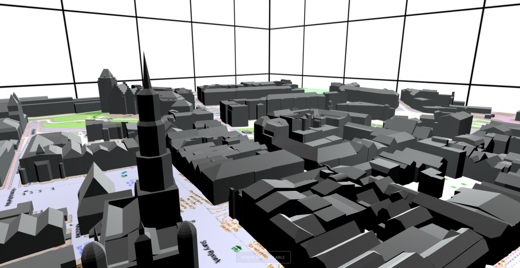
On 21.04 I’ll be giving a presentation (in Polish) about spatial media and its use in urban studies. Below is the presentation as well as the list of references.
List of references
Arribas-Bel, D., Kourtit, K., Nijkamp, P., Steenbruggen, J., 2015. Cyber Cities: Social Media as a Tool for Understanding Cities. Appl. Spat. Anal. Policy. https://doi.org/10.1007/s12061-015-9154-2
Ball, J., 2002. Towards a methodology for mapping ‘regions for sustainability’ using PPGIS. Prog. Plan. 58, 81–140. https://doi.org/10.1016/S0305-9006(02)00020-X
Berger, V., 2020. Phenomenology of Online Spaces: Interpreting Late Modern Spatialities. Hum. Stud. 43, 603–626. https://doi.org/10.1007/s10746-020-09545-4
Bos, D., 2021. Geography and virtual reality. Geogr. Compass 15, e12590. https://doi.org/10.1111/gec3.12590
Bos, D., Miller, S., Bull, E., 2021. Using virtual reality (VR) for teaching and learning in geography: fieldwork, analytical skills, and employability. J. Geogr. High. Educ. 1–10. https://doi.org/10.1080/03098265.2021.1901867
Champion, E.M., 2021. Rethinking Virtual Places. Indiana University Press.
Çöltekin, A., Lochhead, I., Madden, M., Christophe, S., Devaux, A., Pettit, C., Lock, O., Shukla, S., Herman, L., Stachoň, Z., Kubíček, P., Snopková, D., Bernardes, S., Hedley, N., 2020. Extended Reality in Spatial Sciences: A Review of Research Challenges and Future Directions. ISPRS Int. J. Geo-Inf. 9, 439. https://doi.org/10.3390/ijgi9070439
Crampton, J.W., 2009. Cartography: Maps 2.0. Prog. Hum. Geogr. 33, 91–100.
Crutcher, M., Zook, M., 2009. Placemarks and waterlines: Racialized cyberscapes in post-Katrina Google Earth. Geoforum 40, 523–534.
Gordon, E., Silva, A. de S. e, 2011. Net locality: why location matters in a networked world. Wiley-Blackwell, Chichester, West Sussex ; Malden, MA.
Hawelka, B., Sitko, I., Beinat, E., Sobolevsky, S., Kazakopoulos, P., Ratti, C., 2014. Geo-located Twitter as proxy for global mobility patterns. Cartogr. Geogr. Inf. Sci. 41, 260–271. https://doi.org/10.1080/15230406.2014.890072
Hollenstein, L., Purves, R., 2010. Exploring place through user-generated content: Using Flickr tags to describe city cores. J. Spat. Inf. Sci. 21–48.
Janc, K., Jurkowski, W., 2020. Media spo\lecznościowe w czasie pandemii–przyk\lad profili wroc\lawskich rad osiedla na Facebooku. Rozw. Reg. Polityka Reg. 9–24.
Kaji, S., Kolivand, H., Madani, R., Salehinia, M., Shafaie, M., 2018. Augmented reality in smart cities: applications and limitations. J. Eng. Technol. 6, 19.
Kitchin, R., 2017. Understanding spatial media, 1st edition. ed. SAGE Inc, Thousand Oaks, CA.
Kitchin, R., Young, G.W., Dawkins, O., 2021. Planning and 3D Spatial Media: Progress, Prospects, and the Knowledge and Experiences of Local Government Planners in Ireland. Plan. Theory Pract. 1–19. https://doi.org/10.1080/14649357.2021.1921832
Kotus, J., Rzeszewski, M., Bajerski, A., 2018. Visitors in Urban Structures: Students and Tourists in the City.
Lee, R., Wakamiya, S., Sumiya, K., 2013. Urban area characterization based on crowd behavioral lifelogs over Twitter. Pers. Ubiquitous Comput. 17, 605–620. https://doi.org/10.1007/s00779-012-0510-9
Leszczynski, A., 2015. Spatial media/tion. Prog. Hum. Geogr. 39, 729–751. https://doi.org/10.1177/0309132514558443
Li, Y., Li, Q., Shan, J., 2017. Discover Patterns and Mobility of Twitter Users—A Study of Four US College Cities. ISPRS Int. J. Geo-Inf. 6, 42. https://doi.org/10.3390/ijgi6020042
Lin, H., Batty, M., 2009. Virtual geographic environments: a primer. Virtual Geogr. Environ. Sci. Press Beijing 1–10.
Massey, D., 2005. For space. Sage.
Mattern, S., 2017. Urban Dashboards, in: Understanding Spatial Media. SAGE Publications Ltd, 1 Oliver’s Yard, 55 City Road London EC1Y 1SP, pp. 74–83. https://doi.org/10.4135/9781526425850.n7
Mekni, M., 2018. Spatial simulation using abstraction of virtual geographic environments. Int. J. Digit. Earth 11, 334–355. https://doi.org/10.1080/17538947.2017.1381190
Moorman, L., Cerney, D., Gielstra, D., Foster, E., Villa Cerveny, N., 2021. From Real to Virtual Reality–Using the Geographic Advantage with Emerging Technology to Pivot an International Interdisciplinary Experience. Geogr. Teach. 18, 107–116. https://doi.org/10.1080/19338341.2021.1939095
Portman, M.E., Natapov, A., Fisher-Gewirtzman, D., 2015. To go where no man has gone before: Virtual reality in architecture, landscape architecture and environmental planning. Comput. Environ. Urban Syst. 54, 376–384. https://doi.org/10.1016/j.compenvurbsys.2015.05.001
Rzeszewski, M., 2018. Geosocial capta in geographical research – a critical analysis. Cartogr. Geogr. Inf. Sci. 18–30. https://doi.org/10.1080/15230406.2016.1229221
Rzeszewski, M., 2015. Cyberpejzaż miasta w trakcie megawydarzenia: Poznań, Euro 2012 i Twitter. Stud. Reg. Lokal. 123–137.
Rzeszewski, M., Evans, L., 2020. Virtual place during quarantine – a curious case of VRChat. Rozw. Reg. Polityka Reg. 57–75. https://doi.org/10.14746/rrpr.2020.51.06
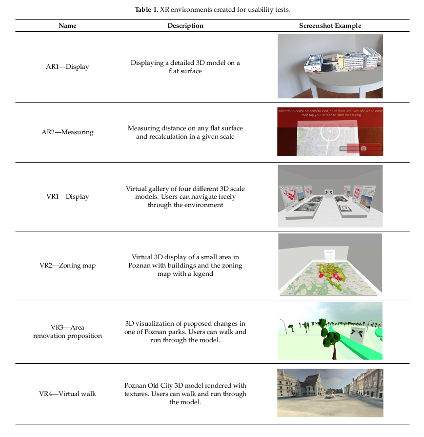
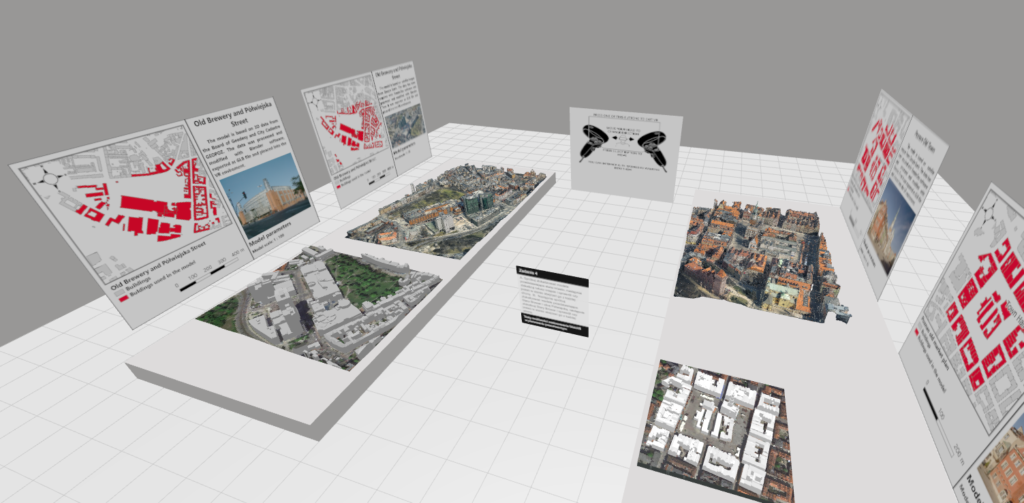
Rzeszewski, M., Orylski, M., 2021. Usability of WebXR Visualizations in Urban Planning. ISPRS Int. J. Geo-Inf. 10, 721. https://doi.org/10.3390/ijgi10110721
Saker, M., Frith, J., 2020. Coextensive space: virtual reality and the developing relationship between the body, the digital and physical space. Media Cult. Soc. 016344372093249. https://doi.org/10.1177/0163443720932498
Saßmannshausen, S.M., Radtke, J., Bohn, N., Hussein, H., Randall, D., Pipek, V., 2021. Citizen-Centered Design in Urban Planning: How Augmented Reality can be used in Citizen Participation Processes, in: Designing Interactive Systems Conference 2021. Presented at the DIS ’21: Designing Interactive Systems Conference 2021, ACM, Virtual Event USA, pp. 250–265. https://doi.org/10.1145/3461778.3462130
Shelton, T., Poorthuis, A., Graham, M., Zook, M., 2014. Mapping the data shadows of Hurricane Sandy: Uncovering the sociospatial dimensions of ‘big data.’ Geoforum 52, 167–179.
Ugwitz, P., Juřík, V., Herman, L., Stachoň, Z., Kubíček, P., Šašinka, Č., 2019. Spatial Analysis of Navigation in Virtual Geographic Environments 22.
Unwin, D.J., Fisher, P., 2002. Virtual reality in geography. Taylor & Francis, London; New York.
Zasina, J., 2018. The Instagram Image of the City. Insights from Lodz, Poland. Bull. Geogr. Socio-Econ. Ser. 42, 213–225. https://doi.org/10.2478/bog-2018-0040
Zook, M., 2017. Crowd-sourcing the smart city: Using big geosocial media metrics in urban governance. Big Data Soc. 4, 205395171769438. https://doi.org/10.1177/2053951717694384
Zook, M.A., Graham, M., 2007. The creative reconstruction of the Internet: Google and the privatization of cyberspace and DigiPlace. Geoforum 38, 1322–1343.

 We are happy to introduce